
Yellowstone 2008: day 3
Having rested up after an amazing amount of driving the previous few days, it was back on the road again, destination Cody, WY. While there are plenty of attractions right around Custer, like Sylvan Lake, Wind Cave, and Jewel Cave, time was going to be a factor as we definitely wanted to stop at Devils Tower along the way. Most of the routes we took were two-lane rural routes which were practically deserted, but full of spectacular scenery. On the way, we stopped at Jewel Cave National Park, but guided tours (a necessity) were not scheduled to start for a few hours from when we arrived. We looked around the bookstore and marveled at the interactive map of the cave system below us. I think this would be a worthwhile stop someday, along with Wind Cave. Back on the road, we were to Devils Tower in about two hours.
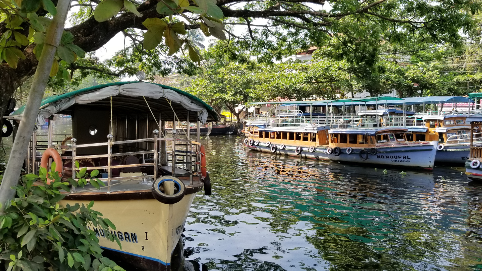
Northern Wyoming has some incredible terrain, and while driving through some sizable foothills, Devils Tower makes a statement. Like Mt Rushmore and the Badlands, I had seen photos but we never terribly impressed. What a difference seeing these things in person makes. From a distance, it really is not much too look at, but certainly recognizable. Getting closer, you can see the amazing patterns in the rock that photos just cannot seem to do justice. We checked out the visitors center and decided to go for a walk closer to the mountain. They have a very nice path a little over a mile that circles the mountain, giving some amazing views of both the mountain and the valley below. We observed a group of climbers making an ascent (that would have to be incredible to see the top, about the size of a football field) and a small group of deer grazing. When we got back to the parking lot, we pulled the car around so we could sit and eat some lunch with a view. Near the base of the mountain is a small field called prairie dog town. I recommend stopping for a bit to observe and hear the high pitched squeaks from the hundreds and hundreds of prairie dogs that call this home. All in all, Devils Tower was a very fun stop along the way to Yellowstone.
Jen took over driving at this point, and I think the fresh air and lunch tired me out. I woke up somewhere between Gillette and Buffalo as we were rounding a bend to see the Big Horn Mountains looming in the distance. Our itinerary had us taking US-16 (the Cloud Peak Skyway) which cuts through the Big Horn Mountains and offers beautiful scenery. One interesting thing did happen, around 9,000ft, the Kia threw a Check Engine light. Not panicking, I checked the owners manual which indicated an emissions sensor and to get it checked eventually. I figured either an oxygen sensor or a fuel pressure sensor. We stopped at a pullout, threw a couple of snowballs at each other, checked for venting from the engine, and proceeded on despite the sensor light. Once out of the mountains, there is beautiful canyon the road winds through on the way to Worland. We stopped and took lots of pictures and enjoyed the solitude it offered with no buildings or power lines or other cars for that matter. We eventually arrived at Worland were we stopped for fuel and some cold beverages. Amazingly, the emissions sensor light decided we were at a low enough elevation and went out (but it would return the next day). One more interesting vehicle note, around the time the emissions light came on, the Kia started to get amazing fuel efficiency, more then I've ever had with that car. I normally get around 30 MPG but was mysteriously getting more along the lines of 38 MPG....I'll take it.
The rest of the drive to Cody was through some of the most deserted land I have ever seen. It is amazing as there is nothing as far as the eye can see. It was very weird, yet oddly comforting. Cody is an interesting town, obviously built around tourism and not much more. Small mountain towns kinda creep m out in a way...probably seen one too many horror films. We had dinner at the historic Irma Hotel, serving a fine piece of steak, as any Wyoming restaurant should! The last highlight of the evening came as I was going to brush my teeth that evening. I went to remove the cap from my tooth brush and discovered a bee lodged in between the plastic and the bristles (the cap is clear, so I could see him in there). After much debate we managed to get the cap off the brush which was then discarded into the parking lot with bee in tow. We did find the cap the next morning sans bee. We guessed he must have hitched a ride a Devils Tower...
Tags
Yellowstone 2008: day 2
The one good thing (and only one) about having an east facing hotel room is that you will be up with the crack of dawn. Oh sure, hotels have some of the most opaque curtains known to man (lead lined I think...good for blocking radiation) but there will always be cracks around the edges or down the middle where the two halves meet (the light rays bend and meet at the focal point...don't ask, Physics Lab joke). So despite a very long drive from the day before, I find it very heard to sleep with the room naturally illuminated. No matter though, we had a big drive ahead of us again, but with the promise of fun with scheduled stops at the Badlands, Wall Drug, and Mt. Rushmore. We took advantage of the hotels complimentary continental breakfast (sweet buttermilk pancakes, they had biscuits and gravy...I love the midwest) and hit the road early with a good start to the day.
There was very little left to drive in Minnesota, and no sooner did we hit South Dakota when we started seeing billboards for both Wall Drug and the Corn Palace. I do recall seeing blurbs about the Corn Palace on Roadside America, and what good would a road trip be without experiencing some of the prime oddities of the west. The clincher was that there happened to be a Cabela's at the same exit. Yours truly, the decorated Eagle Scout, forgot to pack a rain coat in his fervor to hit the road the day before. I figure that would be a good location to acquire the necessary outerwear as rain/snow was in the forecast for several of the days we would be in Yellowstone. The Corn Palace was intriguing. A visitor center and convention hall that also doubles as a basketball court for the local high school. I was more surprised by how many of my friends and co-workers have both been to and admitted being at the Corn Palace. It really is a delightful roadside oddity. We spent a little time perusing the gift shop (corn related memorabilia acquired) and also found a great deal on a rain coat/wind breaker at Cabela's before hitting the road again.
Our next stop was the Badlands National Park. We opted to take the scenic drive which ends up in Wall, SD. Having only seen a limited number of pictures (perhaps a few viewmaster reels in my youth) of this park previously, I was not aware of the scope and variety of formations. We walked a trail and checked out the visitors center, along with almost every scenic viewpoint available. I would have liked more time to spend in the park, and I could easily see going back there in the future to spend a day or two in the area (there is a minuteman missile silo run by the national park service just north of there).
The Badlands scenic byway dumps you out very close to Wall, SD, home of Wall Drug. If the dozens of billboards along I-90 in South Dakota didn't get your attention, the numerous welcome signs near Wall should do it. The setting is a western town meets three ring circus. Of course we had to stop and get pictures and our obligatory authentic Stetson hats. With time running out in the day, we had even less time to spend in Wall then we had at the Badlands. We still had about 100 miles to go to get to our hotel, along with a stop a Mt. Rushmore.
I never had a burning desire to go to Mt. Rushmore, presidential history is not a strong interest of mine. All the pictures I had seen made it seem much smaller then it actually is. Winding our way through twisting and turning roads around Keystone (a bit "touristy" of a town for me) we made our way to the main visitors center. We arrived after most of the museum portions had closed for the day, but we were still able to get to the main viewing pavilion. I must say that I was impressed with scale and magnitude of the carvings. Something like that can never truly translate from photographs. We sat and enjoyed the cool evening air while taking turns with the binoculars and taking silly pictures. After a quick perusal of the gift shop (mini Mt. Rushmore puchased, now sitting on my monitor in my office), it was back on the road and a short drive to Custer for the night.
We wanted to take in a few other attractions that day, but time would just not allow for it. We stopped at the Crazy Horse Memorial which was closing for the night (perhaps another year), and decided to skip Sylvan Lake in Custer State Park also. We found our hotel and a small pub/restaurant before calling it an evening after 500 miles behind us. The next day would find us in Wyoming with a much anticipated stop at Devils Tower before winding up in Cody for the evening.
Tags
9 days and 3,700 miles: Yellowstone 2008: day 1
Saturday, May 17th, a great day to start a multi thousand-mile road trip. It was Jen and my 11th wedding anniversary, and the start of a trip we have been planning for months. We carefully planned our clothing and electronics (at least for Yellowstone, I neglected to see how hot it would be on the actual trip there), we secured a bunny sitter (Thanks Carl!), and updated the Garmin vehicle icon to the Black Pearl among other important preparations. After a marathon packing session the previous evening and part of Saturday morning, we bid the bunnies goodbye and hit the road around 10:00 am.
Our route to the park took us out I-90, through Wisconsin, South Dakota, and Wyoming. Unfortunately, this also included Chicago and Rockford Illinois. I have made this junket many times before, and I can never seem to find a good time to drive through Chicago. If it's not the ridiculous amount of traffic, it's Illinois' unrealistic road construction goals exasperating said traffic (really, 25 miles of single-lane traffic near Rockford with approximately one mile of actual active road work? I call lazy...move the darn barrels when you need to work on that section). I really do give credit to anyone that has to commute in Chicago on a regular basis, I personally could not do that myself, at least not without eventually serving some mandatory federal prison sentence. After missing one toll gate due to heavy traffic (thanks to the state of Illinois for a convenient website to pay missed tolls...I know I probably could have ignored missing an 80 cent toll, but best to be accountable...and somewhat funny using a credit card online to pay 80 cents) we finally greeted Wisconsin and the promise of cheese curds with open arms (queue Journey).
You see, I-90 comes very close to Tomah and the home of Humbird Cheese. While you can obtain cheese curds at almost any exit in Wisconsin (and complimentary with AAA roadside assistance), the squeaky freshest are always at Humbird. While I'm not sure if this is a factual statement, this stop in Tomah is almost mandatory for Jen and I (certainly a tradition, we used to stop there on our trips to Minneapolis/St. Paul, and it's been a while). With snacks and the all-important strawberry-rhubarb jam obtained and the car refueled, we made like Lee Nails and pressed on to our destination for the evening: Jackson, MN.
But there is so much more before that, well, not really actually. Southern Minnesota is somewhat dull, at least after the Mississippi river valley which is very stunning this time of year. I was very surprised to see the number of wind turbines both active and under construction though. It makes me smile to see them gracefully spinning in the distance, and nice to see an investment in alternative energy. With the sun setting, we wrapped up our eleven hour and seven hundred mile leg of day one by arriving at the AmericInn in Jackson. The laugh of the evening came from the receptionist. We stated we had reservations for the evening (although given the five other vehicles in the parking lot, reservations where probably not needed) to which she smiled and said "I've been waiting all day to hear you pronounce that last name". Oh, we did have a few more smiles that evening (keep your minds out of the gutter). We found a small Ma/Pa restaurant very close to the hotel and written on the pane glass windows were various specialties. The one that stuck with us and remained our interjection throughout the trip was "Sweet Buttermilk Pancakes" (used in context: Sweet Buttermilk Pancakes, that's a lot of cheese...). The other smile was watching llamas at a farm across the street. Llamas make me smile....
Tomorrow: South Dakota and the Corn Palace...oh and some place called the Badlands and Mt. Rushmore...
Tags
A walk in the park...
Having no solid plans, we stopped out to Harrison Lake State Park in Fulton County Ohio. It was a little past noon so we picked up a sandwich from Subway and had ourselves a little picnic. We loaded up the kites but decided to take a stroll around the lake. Turns out it was about 3.5 miles around the lake, but it felt good to walk that distance. One of the events along the trail was witnessing a garter snake attempt to eat a bullfrog. That was one ambitious little snake, but there was no way it was going to complete the task, and the bullfrog looked more annoyed than anything. When we approached the feast, the snake was either startled or saw us as a bigger opportunity. It released the frog and eventually slithered back into the woods. To celebrate our unexpected exercise, we stopped for ice cream in Wauseon on the way home...
Tags
Ireland 2007: Day 9 Muckross Abbey, Torq Waterfalls, and Kenmare
We awoke to our last full day in Ireland on Thursday. Not wanting to stray too far across the country, we decided to drive the N71 between Killarney and Kenmare to see the many ruins and natural sites along the way. We drove this route a couple of days before, but were on a time table to start the Ring of Kerry after Kenmare, so we skipped many places along the way. We were chatting with the woman at the hotel reception desk trying to pinpoint were the Torq Waterfalls were. She said if we were driving there, we might as well stop at several other points along the way, marking them on a map.
The first stop was Ross Castle, built in the late 1400s by local ruling clan the O'Donoghues. Ross Castle is located in Killarney National Park and is a short drive off N71 right from Killarney. Located right on Lough Leane, there are many boat hires to tour around the lake to places like Innisfallen Island with many ruins. Parking is very easy as this is also one of the many entrances to Killarney National Park. You could easily spend a whole day exploring the park, either on foot, horseback or boat, but we had much more to see along N71.
Our next stop was a few kilometers down the road to Muckross Abbey. Construction began around 1440, about the same time as Ross Castle, and the Abbey opened in 1448. The Yew Tree in the Abbey cloister was planted when the Abbey was built making it over 560 years old and the oldest living thing in Ireland. The Abbey was undergoing some minor construction when we visited, largely work to shore up walls, and preserve what is left of it. Much of the Abbey was still open to visitors and is simply amazing to see and touch. This is a must-stop for anyone in the area.
We packed back into the van and drove a few more kilometers to Torq Waterfalls. Part of Killarney National Park, Torq Mountain is a very lush and heavily wooded region of the park. The path leading to the waterfalls is surrounded by so much life it's almost overwhelming. Everything here is alive and the vibrant colors reflect this. When I think back to the wasteland of the Burren a few days earlier, the contrast is staggering. We took some photos of the waterfalls and Roger, Anne, and myself decided to take a short forty-minute walk on the yellow trail. After quite an uphill hike, revealing stunning views of Lough Leane and County Kerry, we eventually made our way back to the parking area where Jen, Dave, and Stephanie were patiently waiting. While the trail was definitely a moderate hike, the short trail to the waterfalls is very easy and should not be missed if you are in the area.
We continued to drive south to Kenmare, stopping at Ladies view for some pictures and food (there is a cafe and gift shop here). Unfortunately, there were problems with the power so the cafe was closed for the day. Everyone was starting to get very hungry for lunch and not wanting a revolt, I remembered a cafe at Moll's Gap a few more kilometers up the road. We loaded up the van and pressed on, through the winding roads of N71 which were even more spectacular in the sunlight (it was quite foggy a few days earlier).
We arrived at Moll's Gap and the Avoca Restaurant. Not being quite sure as to what kind of food to expect, we were overwhelmed by the amazing gourmet quality of the food they had to offer. It was our oasis in the desert. The ladies running the restaurant had a variety of quiche and salads (including a particularly grand mushroom salad). You received a mountain of food which was very reasonably priced. I didn't think I would finish it all, but is so tasty that it didn't seem to be an issue. After days of pub grub, the quality of food in the cafe was refreshing and amazing. Almost too amazing, scary amazing...I almost felt a little like Hansel & Gretel, waiting for the nice ladies to cook us up in a pot...but that never happened, instead we browsed the vast gift shop located here. The tour buses started to roll in from the Ring of Kerry, so we piled back into the van and proceeded to Kenmare.
Kenmare is pretty easy to navigate once you get your bearings. Which, of course, took us several minutes while staring at a map of the town and trying to determine where we were. We finally spotted the tourist information office, which we knew the stone circle to be only a few hundred yards from. The Kenmare Stone Circle is reported to be the biggest in the southwest of Ireland. Stone Circles were built during the Bronze Age (2,200-500 B.C) for ritual and ceremonial purposes. They were often orientated on certain solar and lunar events, such as the position of the sun on the horizon on a solstice. In the center of the circle is a Boulder Dolmen, which is unique for stone circles. Dolmen's often marked the burial place of someone important. We spent a while playing, relaxing, and enjoying the sunshine and mild temperatures.
The day was wearing on so we decided to head back to Killarney and the hotel to freshen up for dinner. Once back in town, we located Murphy's Pub on College Street (right behind our hotel). A gentleman in the corner of the pub recommended the Guinness Stew (reported to be the best in the area, if not the country) which a few people did try and enjoyed. I had the fish & chips (something I had been wanting since we arrived) and pint. We had a great evening listening to live music at The Grand (I think that was the name) located on Main St, a short walk from the hotel. We didn't stay out too late though. We had an early morning with a two-hour drive back to Shannon to catch our flight to the states. We packed up that night feeling a little blue. I think this was the first vacation Jen and I had taken where we felt we belonged...so anyone up for Ireland in 2010?
Ireland 2007: Day 8 Waterford, Kilkenny, and Cashel
There was really only a handful of things I wanted to do and planned for when we went to Ireland, one of them was taking Jen to see the Waterford Crystal Factory. Jen, Stephanie, Dave, and myself packed up and hit the road. Ann and Roger were going to drive out to see some of the ring forts on the Ring of Kerry we had seen the day before. Both groups discussed going to see the Rock of Cashel later in the day, but without cell phones, there was no way to coordinate this, so we planned to meet for dinner or drinks later that night. Waterford is no short journey being a good 2 hours away from Killarney (on a good day with a breeze to your back) unless you get stuck behind a trailer hauling a horse. Since two-lane routes in Ireland are almost non-existent, if you get stuck behind a slow-moving vehicle on a busy route, you may be there for a while. We managed to pass the trailer a few kilometers outside of Lismore where we had to stop for fuel. Getting back on the road we noticed a few cars ahead of us were the same horse trailer. It was just not our day on the road and we arrived in Waterford an hour later then we wanted to. On the plus side, the Crystal Factory was very easy to find and tours start quite frequently. The tour is only about an hour and takes you through a working factory showing glass blowing, inspection, marking, etching, custom carving/molding, and hand engraving. The tour ends up at the factory store (how convenient) which is stocked with many items you may not find in the states. We shopped for a few small trinkets and had lunch at the visitor center cafeteria (very big cookies to be had).
Still running behind schedule, we headed north to Kilkenny to see Kilkenny Castle, a fully furnished 17th-century castle. Tours are limited in size and fill up fast. When we arrived in Kilkenny we managed to get lost, yet again. but soon recovered after a nice petrol station clerk pointed us in the proper direction. Parking is not very easy either, but we finally made it to the castle. The tour was at least 45 minutes from starting and it was already late in the day. We opted to skip the tour this time and take some pictures around the grounds (btw, cameras and bags are not allowed inside the castle) since we also still wanted to get to Cashel. When leaving Kilkenny, we noticed this giant black limestone statue/head/bust on Parliament St. We don't know who it was supposed to be a monument to, but there were people gathered around touching it. I think the conversation in the car went something like this:
Stephanie: Why are they touching that head
Dave: Maybe candy comes out of it
Craig: Ooo, maybe giant size pez, like the size of a brick
Jen: I want one of those
I guess you had to be there, but trust me, it was a comedy moment that had me gasping for breath I was laughing so hard.
Onwards to Cashel! Being disappointed by not taking the Kilkenny Castle tour and running late in general, we drove to Cashel. Any disappointment we had would soon be forgotten when we saw The Rock of Cashel looming in the distance. We parked the car and ran to it like kids in a toy store. The ruins are absolutely amazing as is the surrounding countryside. While exploring the main cathedral, we ran into Anne and Roger (we even parked right next to their car and did not notice). We were all quite surprised to see each other and had a good time describing the adventures we had that day. We took a lot of time exploring the grounds as there is so much to see. We eventually closed the place down before heading over to the Hore Abbey (yup, that's spelled correctly), located near the base of the Rock. There is no admission to get into the Abbey, and really not much as for as information. You can explore it extensively though (I do love history you can go up to and touch). We explored the grounds for a bit before the sun started to get lower to the horizon. We found a nice and cheap restaurant in Cashel before heading back to the vehicles and back to Killarney (still about 2 hours away). Anne and Roger headed straight back while the rest of us made a quick detour to Tipperary. It was only about twenty kilometers away (not a long, long way at all) so we had to drive through so at least we could say we'd been to Tipperary. We eventually got back to the hotel and had a pint before sleep could no longer be held at bay.
Ireland 2007: Day 7 The Ring of Kerry
The rain had finally ended when we woke up on Tuesday morning. There was still a light fog and mist around Killarney, but the pounding drizzle had subsided. Anne & Roger were intent on climbing Carrauntuhil, Ireland's highest mountain located in county Kerry (very close to Killarney actually). The rest of us decided to take a day trip and drive the Ring of Kerry. Most tourist books and maps will show the driving loop as counter-clockwise, and most of the tour buses will take that route also. Acting on a tip from a Rick Steves guide, we drove the loop clockwise to avoid the traffic and crowds.
The drive starts out going south from Killarney to Kenmare. There is a national park/forest situated in this area, so the scenery is incredible. The roads are also very narrow and winding as they cut through the rugged terrain separating these two towns. We stopped by Upper Lake for a few pictures of the clouds rolling over the higher elevations. There are also a few great stops along this route. The first of which is Ladies View, a scenic lookout on N71. The name apparently stems from the admiration of the view given by Queen Victoria's ladies-in-waiting during their 1861 visit. The next stop is Moll's Gap. The Kenmare valley to the south is linked to the mountains of the Iveragh Peninsula only by this relatively low ridge at the western end. There is a great little restaurant here that I will describe in my day 9 recap.
The Ring of Kerry starts up just before Kenmare and most of the interesting sites are after the town of Sneem. Our first site on the Ring was just outside of Castlecove: Staigue Fort. A stone ring fort built during the Celtic period, probably around the first century BC. The fort sits in a valley, surrounded on three sides by rugged mountain terrain and a clear view to the Kenmare River. The fort is also surrounded by grazing sheep, so watch your step! The road leading to the fort is quite narrow, usually only wide enough for one vehicle in most areas, so I don't think tour buses make this a frequent stop.
We stopped along many of the scenic lookouts around Derrynane Bay, a very rocky harbor that is sparsely populated. At one stop, we could hear sheep, but could not see them. We looked around the bend in the road and saw a few of them by a fence. Since they were so noticeably audible, we decided to mimic their bleating which made them even more chatty. The funny thing is that when we started doing this, a few dozen more joined them at the fence. Our guess is that they wanted something to eat.
We continued on to Waterville. A small town located on Ballinskelligs Bay and an excellent place to stop for a Scones and Tea break. We stopped by The Chedean Cafe were the service was as wonderful as the food. Still feeling a little punchy from the drive, a sample conversation from the Cafe:
Dave: What is the proper way to eat a Scone in Ireland?
Craig: You chew it with your back teeth
That little snippet of conversation followed us everywhere we went after that...Finishing our lite lunch, we strolled around the beach and took some pictures with Charlie Chaplin (a monument by the beach). Waterville is a charming little village, but we had more of the Ring to explore, so it was back to the road.
Near Waterville is a point where you can split off the Ring of Kerry (rejoining it later) on to the Skellings Ring. This is a short driving loop that many tour buses avoid due to narrow and steep roads. The weather was starting to show vast improvements (blue sky peeking through the clouds) so we decided to take the driving loop. The bigger decision was the Skelligs Chocolate Factory, but we'll discuss that in a moment. The Skellig Ring takes you through a few small villages with a large number of ruins and abandoned homes (from the famine and subsequent emigration) while it twists along the rugged coastline of St. Finan's Bay. Along this route, you will find the Skelligs Chocolate Factory. I highly recommend this stop. There are free samples of some amazing combinations and flavors. We dropped quite a few Euro, but it was well worth it.
Shortly after the factory, there is a nice, albeit rocky, beach to stop and enjoy your purchases. This is a good place to relax before the R-566 pass that takes you to Portmagee. I think this mountain pass is one of the main reasons tour buses avoid this route. I thought we were going to burn out the transmission at several points going uphill. Once at the top there is a nice parking area where you can take in the valley below (Portmagee) on one side, and the Atlantic Ocean on the other (and let your car transmission cool off). We had a few moments of nice scenery before a large cloud rolled in and blocked everything out. We put the van in neutral and coasted down the other side towards Portmagee, riding the brakes and still hitting 100K/m.
Portmagee is a brightly colored harbor town where most Skellig Island boat tours originate from. There is no guarantee when they will run, as the conditions on the Atlantic Ocean dictate that. On this side of the R-566 pass, the sun had finally come out and it was becoming a very pleasant afternoon. We stopped for lunch at the Morrings Pub before crossing over the bridge to Valencia Island. The island has a nice driving loop that takes you along the highest points before ending in Knights Town where you can catch a ferry back the mainland (only 5 Euro for a car) and cut 20 minutes off your drive be not backtracking to Portmagee.
Very close to the ferry port is the town of Cahersiveen. A bridge in town will take you to the Cahergall ring fort. While the Staigue Fort was interesting, this ring fort is massive. The walls are very high and thick and you can walk along the entire perimeter. There is also a second ring fort very nearby (the entrance is hidden around the east side of the fort. This one is significantly smaller, but worth checking out. We walked around the perimeter but could not find the entrance (Anne and Roger went there the next day and told us where to find it). We did get some great pictures of sheep though! One more very close attraction is the ruins of Ballycarberry Castle. The terrain is fairly flat and the castle stands out from a distance.
It was back on the road for us and back to Killarney. We had a great day and wrapped up the evening at a small Thai restaurant along High Street and drinks at the hotel pub that evening. Anne and Roger recounted their adventures in mountain climbing and we turned in for the evening so to be rested for the next days' adventure!
Ireland 2007: Day 6 The Pounding Drizzle of Killarney
We knew this day would come. We packed and prepared and understood that Ireland is green for a reason: rain. This actually gave us a good excuse to lounge around the castle, as one does in Ireland, before hitting the bricks for Killarney. Ballyseede Castle, like the Old Ground hotel, had a traditional Irish breakfast set in a very elegant dining room. We returned to our rooms and finished packing and getting ready to travel again. We spent a little time in the drawing-room planning our trip to Killarney (a short drive by comparison to the day before) while Dave and Roger played chess and Stephanie gave us an impromptu recital on the castles piano. After the rain had let up a bit, we loaded up the cars and headed towards Killarney.
Killarney is a popular tourist town where some sections streets are lined with tour buses. The town has an abundance of hotels and restaurants and is a good jump point to areas like the Ring of Kerry and other area attractions. Like most towns in Ireland, we found our street map was woefully inadequate. After driving down High street a couple of times we finally managed to find our hotel, the Killarney International, which was only a minor victory. We needed to find a place to park next. The hotel is located near the town center and does not have its own parking lot. The next best thing was a pay lot at the end of the block. Perhaps it was the drive down to Killarney and getting lost trying to find our hotel, maybe the lack of parking, or just the fact that we had to walk to the hotel in what can only be described as "pounding drizzle", but Craig was not in the best of moods. That soon faded though, even if we did have to pay to park, it was only between 9 am and 6 pm, when we would be out driving somewhere, so it really wasn't that big of a deal. We left the luggage in the cars and hoofed it to the hotel lobby.
We were still a little early for check-in, but the rooms were all ready which was a welcome relief. We opted to go check out our rooms first before retrieving the luggage. The hotel is wedged in between several other buildings and we began to refer to it as the MC Escher hotel. The halls and staircases would twist and turn with no obvious structured floor plan...perhaps calling it the Winchester Mansion hotel would be more appropriate. At one point, there were two different hallways that both point to our room number but looked to be going in opposite directions. We finally found our room (really quite appropriate to not only get lost in Killarney, but lost in our own hotel) which was very modern in comparison to everywhere else we stayed (complete with hot tub and flat panel TV).
After freshening up a bit, Roger and I ran back to the van so I could pull it around and unload the luggage, (no need to haul it through the rain). We paid for the rest of the day at the lot and decided to explore a bit of Killarney despite the rain/drizzle. The first stop was to acquire some lunch. Right across the street from the hotel was a tiny pizzeria, just the thing for a rainy day. Feeling a bit refreshed, we stopped out to the Killarney Outlet Shops (not to be confused with the outlet shops we have here, it really is more of a shopping mall where things are a little more expensive). Anne and Roger were intending on climbing the highest mountain in Ireland and needed some outdoor supplies like a compass. Having acquired that, the next stop was the local TI (Tourist Information Office).
I like to think I had done a pretty good job of finding activities to do up until this point, but the only thing I really had for the Killarney area was the Ring of Kerry and a day trip to Waterford. The TI had some other brochures of area attractions as well as a pretty good gift shop. We all split up and decided to meet in the hotel lobby for dinner at a set time. Jen and I roamed the streets of Killarney in search of trinkets and gifts as well as a good place for dinner. Killarney is not lacking in gift shops which is good for bargain hunters or people on a budget. We made note of several restaurant ideas to pitch to the crew and returned to the hotel to relax for a bit.
Anne & Roger may have spent a bit too much time in the rain since they had lost their voices and wanted to spend the rest of the evening resting up. Dave, Stephanie, Jen, and myself headed to the logical choice in restaurants when in Ireland: Chinese. I was very pleased to see some Irish inspired dishes. I've never had a garlic salmon dish before, at least not quite like that, but it was very tasty. We returned to the hotel to meet in the local pub and discuss Tuesdays adventure over a well-deserved pint: the Ring of Kerry.
Ireland 2007: Day 5 Ballyseede Castle & The Dingle Peninsula
The morning of Day 5 was the closing of the chapter on Ennis and the start of the adventure in Tralee. We spent the morning having our traditional Irish fare one last time at the Old Ground Hotel and figured out directions to Tralee and the Ballyseede Castle Hotel. It would be a long drive taking us back through Shannon and Limerick to Tralee and the edge of the Dingle Peninsula. The driving in Ireland was getting very easy at this point. My subconscious had finally stopped screaming about being on the wrong side of the road (actually I think it left altogether and was waiting at my Kia parked at Detroit Metro) and I was getting the hang of spotting street signs and direction markers.
On the way down to Tralee, we stopped to take some scenic photos before getting to Ballyseede. The castle is more of a fortified mansion, but it says castle in the title, so we officially slept in a castle in Ireland. The castle was undergoing some renovations, so we could not get everywhere, but that was o.k. since we had bigger plans of driving around the Dingle Peninsula and the Slea Head loop (we call it the Dingle Ring). We checked into our rooms, except for Anne & Roger whos room was not quite ready. We also were introduced to Arthur, the castle's Irish Wolfhound who was very docile and slept quite a bit...usually where you wanted to walk through.
We piled in the van and headed towards N86 for our first stop in Camp and Ashe's Tavern for lunch. The pub was very tiny but there were only a few people and that made it even cozier. An older couple also came into the pub a bit later and wanted to talk all about what was going on back in the States and also gave us a lesson in some simple Gaelic phrases. A little bit outside of Camp is a great area to stop alongside the road and take in the valley below.
The next stop/attraction was a little after the town of Dingle (or An Daingean as the Irish government wants it called) to a stone fort known as Dunbeg. As a brief tangent, the story behind the rename of Dingle to An Daingean is quite amusing if you have some to research and read about it, there is a huge push by the government to preserve Irelands heritage which most people are in favor of. But the folks of Dingle are quite against renaming of their town, and many of the welcome signs to An Daingean were spray-painted over with the old name of Dingle.
The Dunbeg Fort is an iron age fortification which is teetering precariously on the edge of the sea. It is a dry stone structure with some amazing views of the coast. On either side of the fort are fields of sheep, natures lawnmower, who all seemed to be attracted to Jen. We figured out the color of her raincoat is close to that of the people that tend and feed them.
Continuing on our drive out to Slea Head, we stopped to get some pictures of a beehive hut (another dry stone structure) and enjoy the winding road and coastal views. Slea Head is at the western edge of Ireland and overlooks the Blasket Islands which were occupied through pre-history until very recently when they were vacated in 1953. The sloping hills and fields overlooking the ocean and islands is quintessential Ireland. The beauty of this sometimes harsh landscape is worth the drive.
We rounded Slea Head and found our way to the Reask Monastic Site. The roads are very narrow leading to this place, so tour buses won't get you there. There are some beautiful stone carvings from early Christianity and a wind fired kiln at the south end. Nothing remains of the buildings but low walls and a cross-slab standing stone which sits in the middle of the compound. Excavations revealed the ruins of an oratory, four clochans (stone huts), a graveyard, and about ten stone slabs.
Back on the R559, we headed to the Gallarus Oratory, a dry stone church probably built in the 8th or 9th century. The construction is done in such a way to allow rainwater to run off, leaving the inside dry. A tip on seeing the Oratory, when you see the sign for parking on the left, keep driving about 200 yards to a public access point where you can get the Oratory for free. The first parking lot is apparently on someone's property and they charge a small admission fee to cross their land and see the Oratory (thank you, Rick Steves, for pointing that out). There is a gift shop and restrooms there, so if you need any of that, then it's worth stopping at the first parking area.
Our last stop was to the Kilmalkedar Church site. The cemetery is still actively used, and it appeared as though there was some work being done on the ruined church (perhaps to shore up the walls and prevent further crumbling). Kilmalkedar Church is an excellent example of the Irish Romanesque style of architecture and dates back to the 12th century. There is a great stone cross outside of it, along with a sundial and an ogham stone. The stone is said to be a place where people would go to 'seal a deal' by touching thumbs through the hole at the top. In modern times, it is used by couples to renew their vows and commitment to one another by touching thumbs then kissing. Located just across the road is another ruined structure of a house or abbey, not really quite sure as there were no markings, but it was fun to explore just the same.
The fog and rain had finally set in so we made our way back to the Castle for the evening (and I think my driving had gotten the better of Anne who missed taking her Dramamine). Jen, Dave, Stephanie, and I opted to head back into Tralee to find some cheap grub. While this sounds really lame, we came across a McDonald's and we all just had to know: was it as bad as it is in America. We stopped for a quick burger, I had a quarter-pounder (which really should be named in some metric equivalent, like the 0.113 kilogram or something...anyhow, the burger was actually quite tasty! A sign in the McDonald's read that they only use Irish beef in their burgers, so no kangaroo.
Back at the Castle, we spent the rest of the evening in the Castle's pub joking with the barkeep and reminiscing on the sites of the day.
Ireland 2007: Day 4 Ennis Franciscan Friary
Having spent everyday driving, we opted to spend the morning in Ennis taking in some of the local attractions since this was our last full day before moving on to Tralee on Sunday. Feeling energized after breakfast we set out on a walk around the town. In the heart of Ennis is incredible ruins of a 13th century Franciscan Friary. Founded by the O'Briens, it has numerous 15/16th century sculptures carved in the local hard limestone. In its glory days it was a flourishing community with 375 friars and 600 students. Much of Ennis actually grew up around the Friary which is the case with most towns in Ireland. The friary has been altered over time to suit the needs of whoever called the shots. The main bell tower now sports the four spires associated with Protestant church style. The admission fee and tour are less than a couple of Euros and is well worth it.
After the tour of the friary, we opted to split up for the rest of the morning so we could do some shopping (a tin whistle and music CDs for Jen and I) and have a leisurely morning. Jen and I walked around town and got some great pictures of the newer Franciscan Friary just to the west of the older ruins. It is located right next to the Poor Clare Monastery and has some great architecture. While walking around, we had a nice conversation with an older Irish gentleman who seemed very eager to talk about the Aran Islands and how we were liking Ennis and County Clare. I think the conversation might have been an excuse for him to put off the lawn work he was doing. Right across the street at the Poor Clare Monastery, there was a nun also doing yard work. We noticed she was also listening to an iPod which made us smile (the scene could have been a century-old based on her habit/clothing and her gardening tools had it not been for the tell-tale white earbuds).
Ennis also has a great open-air market where you can get anything from crepes and pastries to cordless drills. One vendor had an incredible selection of stuffed olives and grape leaves as well as other delights. We picked up a small bag of garlic stuffed green olives to go with our gourmet cheese from the Ailwee Caves and decided to call that lunch. Anne, Roger, Dave, and Stephanie decided to go for a drive to a nearby ring fort while Jen and I opted to stay in Ennis and relax (driving in Ireland takes a lot out of you the first few days). We had lunch in the garden at the Old Ground Hotel while we journaled our thoughts and wrote out postcards. We also watched as the cathedral next door was made ready for a wedding that afternoon. We walked around Ennis a bit more and got some great photos of St. Columba's church on the other side of the river.
By dinner time, the rest of the crew had returned from their day trip with stories and photos. While we were out earlier, we scouted a good pub (Cruise's) to have our last dinner in Ennis. The pub had some great food and started their music early which added to the ambiance. Many of the musicians we recognized from the night before at the Poet's Corner. I guess the all do a circuit of the Pubs and will get together for the Irish version of a jam session. We had dessert from a local "fast-food" restaurant (hot muffin with ice-cream...how could you pass that up?) which we ate while sitting at the steps of the O'Connell monument. I guess we stuck out as tourists as a car of teenagers shouted out "Welcome to Ireland". We are not sure if they were sincere or just having fun...either way we had a good laugh.
While walking back to the hotel, we saw the most amazing thing that made us all think of home: a 1968 Chevrolet Camaro complete with South Carolina plates. We chatted with the driver who had it parked at the end of O'Connell street while his wife/girlfriend was in a nearby shop. He commented that he does not drive it often as it only averages 12 MPG. The car was absolutely beautiful though and every head turned as it drove down O'Connell street.
We had a few pints in the hotel pub while listening to some local music that evening. It was a nice way to wrap up our stay in Ennis at the Old Ground Hotel. I highly recommend this place if you plan on a visit to Ireland.